
Earth Mapping Resources Initiative (EARTH MRI)
The goal of Earth MRI is to improve our knowledge of the geologic framework in the United States and to identify areas that may have the potential to contain undiscovered critical mineral resources. Enhancement of our domestic mineral supply will decrease the Nation’s reliance on foreign sources of minerals that are fundamental to our security and economy.
Learn more about the Earth MRI project on the USGS site
USGS Releases 2022 List of Critical Minerals Related Publications on Lithium in Nevada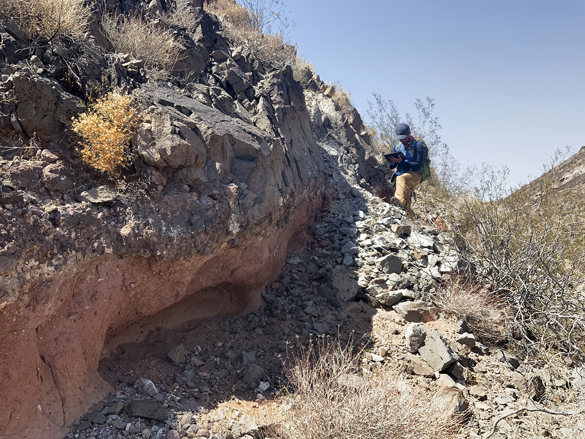
MOUNTAIN PASS REE FOCUS AREA
Andrew V. Zuza, Michael H. Darin, and Seth Dee
NBMG recently completed two new geologic maps, a technical report, and GeMS database conversions of published geologic maps as part of the Mountain Pass REE Focus Area of the USGS Earth MRI initiative. Mountain Pass, CA contains one of the richest REE deposits in the world hosted in Proterozoic gneiss and alkaline granitic rocks. Exposures of Proterozoic orthogneiss extend southward from Mountain Pass in a narrow band that straddles the Nevada / California border, southwest of Las Vegas, NV. In Nevada, these Proterozoic rocks are present in the northern New York Mountains, southern McCullough Range, and Lucy Gray Mountains. Mapping was conducted at 1:24,000 scale, in conjunction with geochemical analyses and geochronology, to provide lithological and structural constraints on the potential distribution of REE deposits beyond Mountain Pass. The mapping depicts six distinct Paleoproterozoic orthogneiss units with new U-Pb ages spanning ca. 1622 to 1675 Ma. Strongly deformed potassic granitic orthogneiss yielded ages of 1657 to 1672 Ma and less-to-undeformed granite yielded ages of ca. 1641 Ma, which brackets deformation between 1.66 Ga and 1.64 Ga. The Paleoproterozoic rocks are unconformably overlain by Tertiary volcanic and sedimentary strata that are deformed by largely north-striking normal faults that accommodated middle to late Miocene tilting and extension, and north-northwest-striking oblique-normal faults that were active during a later phase of deformation in the latest Miocene to Pliocene. Evidence for Quaternary faulting is limited to a set of north- and northeast-striking faults along the western flank of the Lucy Gray Range that displace alluvial fan deposits as young as early Pleistocene. Despite similar Paleoproterozoic bedrock as Mountain Pass, CA, our study did not reveal conditions favorable for an economically significant REE deposit in southern NV.
RHYOLITE RIDGE/CLAYTON VALLEY LITHIUM FOCUS AREA
Michael H. Darin, Matthieu Harlaux, and Izabella Ogilvie
The Rhyolite Ridge focus area in southwestern Nevada is one of the richest lithium districts in the state and the nation. Located within the northern Silver Peak Range and adjacent to North America’s only producing lithium mine in Clayton Valley (Albemarle), Rhyolite Ridge contains economically important sediment-hosted lithium and boron deposits that are nearing development (ioneer). This focus area is tectonically situated in the seismically active southern Walker Lane belt, which has experienced significant magmatism, extension, syn-tectonic sedimentary basin development, and dextral transtension since middle to late Miocene time (ca. 18–5 Ma). Lithium (and boron) mineralization occurs as stratiform deposits within the ~6–5 Ma lacustrine Cave Spring Formation. The main ore section is ~30 m thick and consists of a lower zone composed of searlesite-dominated marl and an upper zone in which lithium is bound in smectite or mixed illite-smectite clays. Despite the discovery and proven lithium resources at Rhyolite Ridge, little is known about the relative influences of structural, stratigraphic, magmatic and hydrothermal controls on the development of lithium-rich basins in general. This knowledge gap inhibits exploration efforts and the identification, characterization, and development of proven and potential new resources.
NBMG is conducting detailed geologic mapping, whole-rock geochemical and structural analyses, and obtaining high-precision geochronology at Rhyolite Ridge to provide a geologic framework for the site and to evaluate linkages between lithium enrichment and basin formation, faulting, and volcanism associated with the coeval 6-Ma Silver Peak volcanic center. Geologic mapping efforts are enhanced by new lidar topographic and airborne geophysical surveys provided by the Geoscience Data Acquisition for Western Nevada (GeoDAWN) project. Preliminary structural analysis indicates consistent WNW-directed extension during both late Miocene slip on the Sliver Peak-Lone Mountain detachment fault and Pliocene-Quaternary slip on high-angle normal and oblique faults. Trace element geochemistry from rhyolitic tuffs and flows underlying the Cave Spring Formation reveal exceptionally high lithium concentrations up to 211 ppm (typical rhyolite/granite <40 ppm), though with notable heterogeneity that inversely correlates with degree of alteration. Field research and analyses are ongoing and will conclude in the fall of 2023. Deliverables will include a 1:24,000-scale geologic map of the focus area (GeMS Level 3), a technical report, and regional compilations of new and published geochemical and geochronological data sets. The results of this research will provide valuable new constraints on the distribution and potential origin of lithium deposits in the Rhyolite Ridge focus area. More broadly, insights into the critical controls on the development of lithium-rich basins can aid in the exploration and identification of undiscovered sediment-hosted lithium resources elsewhere in the United States.
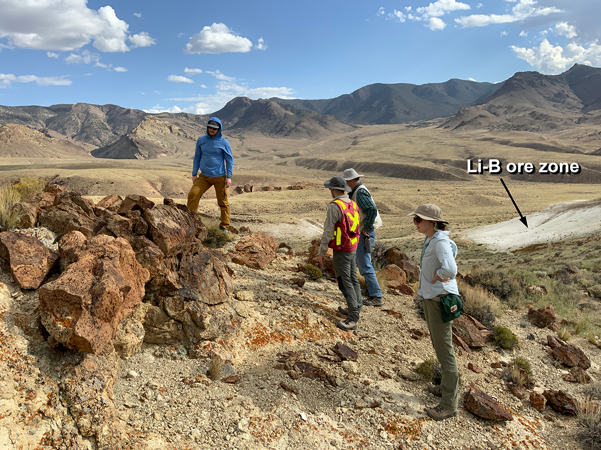
MCDERMITT CALDERA LITHIUM FOCUS AREA
Carolina Muñoz-Saez and Matthieu Harlaux
The proposed work includes the development of a new detailed geologic map, and geochemical, and geochronological analyses focused on the magmatic evolution, structure, and depositional history of Li-bearing sediments of the McDermitt caldera in Humboldt County, Nevada. The primary objectives of the proposed geologic mapping are: (i) to characterize the source rocks for lithium; (ii) to identify the structural and stratigraphic controls on ore formation; (iii) to describe in detail the spatial distribution of Li-bearing sedimentary rocks relative to their source rocks; and (iv) to map regional structures and alteration features based on interpreted high-resolution DEM and geophysical data. Additionally, the proposal involves the compilation of existing geochronological data on the volcanic rocks as well as acquiring new geochronology data from critical stratigraphic units. The 1:24,000-scale quadrangle to be mapped is located in the Thacker Pass area in the southern part of the McDermitt caldera, where most of the Li resources are known.
 Home
Home